Katla Geopark Coastal Mapping Experiences
Join us for a day of learning, walking, tracking, and indulging in picturesque scenes on the rugged coastlines of Katla Geopark! This experience offers a deep dive into the forces of nature that continue to shape Iceland's dynamic landscapes. Whether you're an aspiring geologist or simply eager to participate in an ongoing impactful project... This Coastal Mapping Day Trip will leave you with a profound appreciation for the power of nature.
Katla Geopark Coastal Mapping Experience Objectives:
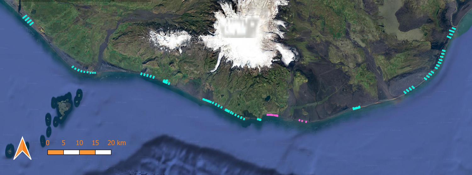
- To examine change in sections / profiles of beaches within Katla Geopark. Which one will be weather dependent. To illustrate, could be one of the following:
- Landeyjasandur (near to Hvolsvöllur and has a shipwreck)
- Holtsós (tidal lagoon under Eyjafjallajökull)
- Eyjafjallasandur (under Eyjafjallajökull)
- Solheimasandur (near to abandoned plane wreck)
- Eyjafjara (near to Vik)
- Hvoll (near to Vik)
- Dyrhólaey (near to Vik)
- Reynisfjara (near to Vik)
- Snid Oddsfjara (near to Vik)
- Alviðruhamrar (between Vik and Kirkjubæjarklaustur)
- Meðallandssandur (near to Kirkjubæjarklaustur)
- Skaftá (east og Kirkjubæjarklaustur)
- Landeyjasandur (near to Hvolsvöllur and has a shipwreck)
- The results are compared with previous measurements.
- Results from the research expedition will track the stability or instability of the area.
- Learn how the beach adapts to changing conditions (IE, Recovering from storms) and what the long-term development of the beach is in relation to erosion from nature and tourist traffic.
Iceland Coastal Mapping Experiences Itinerary:
- Departure: The start time will be dependent on the tide times, weather, and mapping area. TBD within the week of the experience. Note: Please plan to be available the entire day.
- Geoscientist: Under the expert guidance of a knowledgeable Geologist, you'll learn the art and science of coastal mapping, exploring the fascinating interactions between land, sea, and volcanic activity.
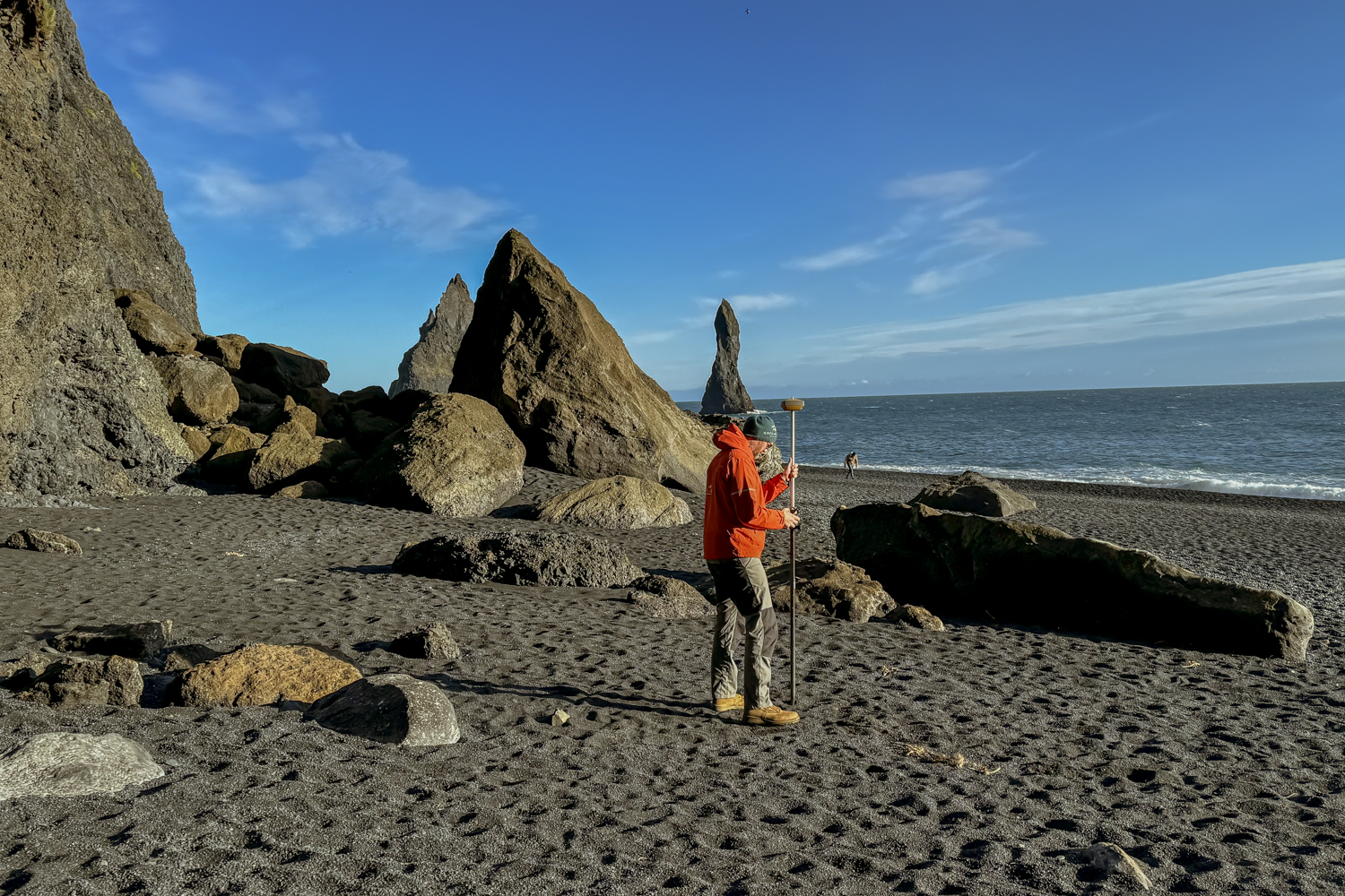
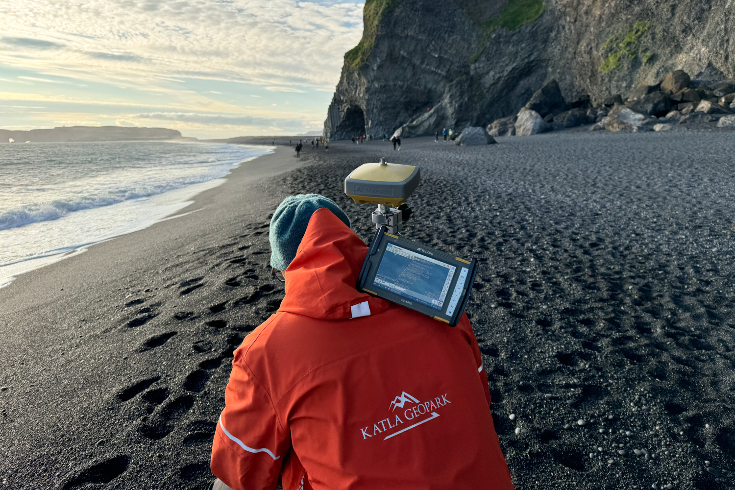
- Hands-On Coastal Mapping: You'll engage in meaningful research of the Icelandic coastlines with these mapping activities. Learn and be empowered to use advanced GPS equipment to measure the sands movement and other vital data. Your contributions will aid ongoing research and help monitor the stability of the coastline within Katla Geopark. Bonus: A few of the South Iceland black sand beaches like Landeyjasandur will offer shipwreck monitoring (IE, How much sand is covering that specific day).
- Geological Insights: Throughout the expedition, your Geoscientist Guide will provide insights into the geological significance of sands and Katla Geopark, explaining how the areas are all interconnected.
- Data Processing: After completing the Katla Geopark Coastal Mapping experience, make your way back down to the designated area classroom. Here, you'll reflect on the day's experiences and learn to process some of the data you captured. Also, you'll have the chance to ask further questions and discuss the significance of your findings.
What’s Included:
- 6-8-hour Expedition from Hvolsvöllur, Vik, or Kirkjubæjarklaustur
- Educational Background Brief
- Professional Geoscientist as your Leader
- All necessary Scientific Equipment (GPS, Drone, Land Photos)
- Data Processing Lesson
- Results & Debrief (additional results may be emailed)
- Citizen Scientist Certificate from Katla Geopark
- Name Published in a Geopark Report
- Ongoing Data Updates via Email
What to Bring:
- Warm, layered clothing suitable for outdoor conditions
- Waterproof Outerwear
- Walking or Hiking Shoes
- A sense of curiosity and adventure
- Small Backpack
- Snacks
Iceland Coastal Mapping Experience Specifics:
Expedition Duration: Approximately 6-8 hours (including travel time)
Difficulty Level: Easy
Meeting Point: Near to Hvolsvöllur, Vik, or Kirkjubæjarklaustur (location dependent on mapping area)
Availability: Year Round
Group Size: Limited to 2-6 people (2 person minimum)
Experience Investment: Please Contact Us to Learn More!
Special Notes: Due to the Scientific nature of this tour, group sizes are limited to ensure each participant receives personalized guidance and training. Katla Geopark reserves the right to make changes to the plan based on weather and safety dynamics (IE, Switching days, empowering other Science-Driven Guides, or changing areas, etc).
Embark on an unforgettable day trip within Katla Geopark, where the raw beauty of Iceland's Southern coast meets the mysteries of ancient volcanic landscapes. This exclusive coastal mapping expedition will guide you through one of the country's most geologically diverse regions. Truly, offering a unique blend of exploration, education, and adventure. Perfect for geology enthusiasts, sand lovers, nature lovers, and curious travelers alike!
Are you ready to delve into the forces that shaped Iceland's dramatic shoreline?
Contact Us to find out more information!
Celebrating Earth Heritage
How to visit the Katla Geopark
Katla UNESCO Global Geopark is in central South Iceland