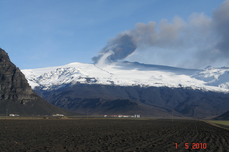
Glacial Outburst Floods
The eruption caused glacial outburst floods, both to the south and to the north of the caldera of Eyjafjallajökull. The outburst floods were caused by melting of glacier ice at the eruption sites. Several outburst floods came down the northern side of the volcano, through the outlet glacier Gígjökull and then drained into Markarfljót glacial river. The first, and the largest, flood came a few hours after the start of the eruption and had a peak discharge of 2.500-3.000 M3s-1 near road 1 over Markarfljót river. That flood was followed by several smaller outburst floods from 14th to 16th of April, and then again by even smaller ones from 21st April to the 5th of May, all of which drained into Markarfljót. These floods cause damage to road 1, levees near the river and on agricultural land nearby.
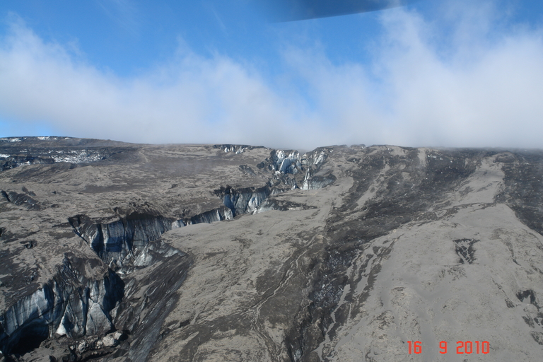
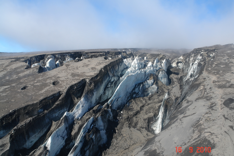
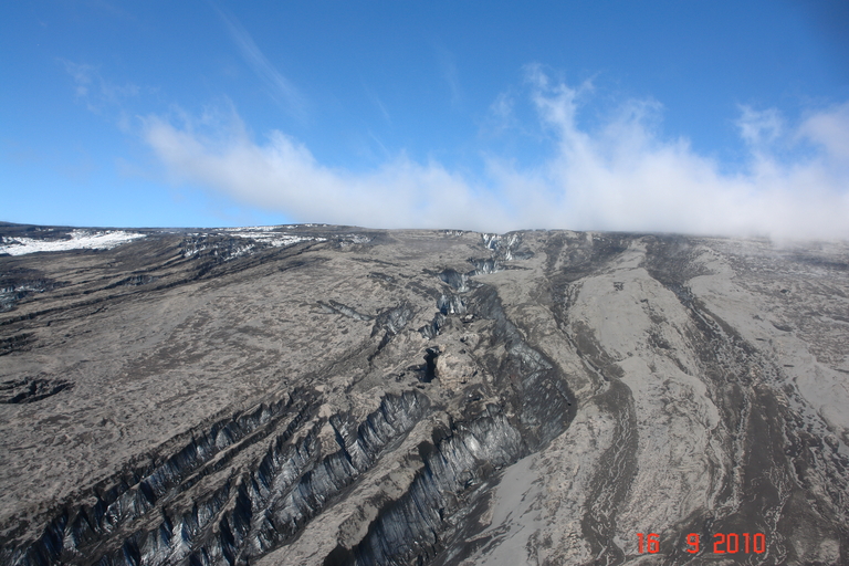
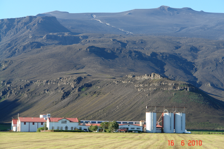
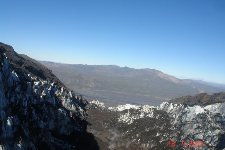
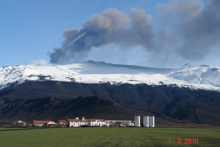
One outburst flood, however, came down the southern side of the volcano and was caused by the short-lived fissure south of the caldera. The flood came down into the valley above Þorvaldseyri farm and drained into the river of Svaðbælisá on the morning of the 14th of April. The flood was small but did cause damage to agricultural land of the farms of Þorvaldseyri and Önundarhorn, along with damaging a flood wall, roads and for a time threaten the small bridge over the river on road 1. The flood carved a 3 km long pathway through the glacier on its way down, which can be seen in the photo. The flood caused erosion in canyons on the mountainside of Eyjafjallajökull and considerable deposition of large rocks and other debris in the valley above Þorvaldseyri farm. Due to the flood, it was decided to build flood walls along Svaðbælisá river to try to contain future flooding, something that would prove to be invaluable later.
Celebrating Earth Heritage
How to visit the Katla Geopark
Katla UNESCO Global Geopark is in central South Iceland