Eruption in Fimmvörðuháls
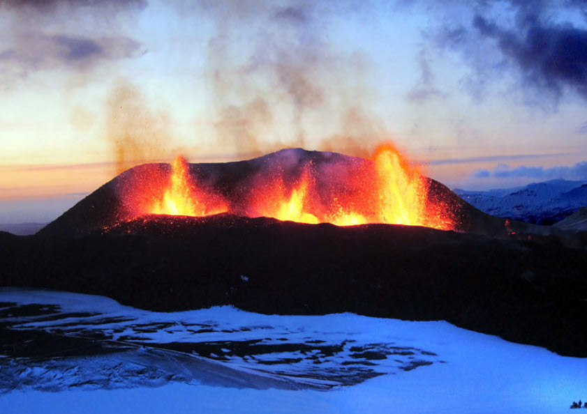
The 2010 eruption of Eyjafjallajökull started on the 20th of March, in an area called Fimmvörðuháls west of the caldera of Eyjafjallajökull. A 300 meter long volcanic fissure opened, and lava started flowing from 15 vents. A day later, on the 31st of March, another fissure opened close to the first one and both fissures were active at the same time. The activity on the fissures quickly started being concentrated, with main two craters forming, one on each fissure. The activity on the two fissures continued until the 8th of April, when no activity was observed from the first fissure anymore. On the 12th of April, the second fissure had also stopped erupting and this part of the eruption came to an end. This part of the eruption was an effusive eruption, meaning that lava flowed freely from the eruption site and there was limited explosive activity and tephra production. The eruption was a typical basaltic fissure eruption with lava fountains reaching up to 180 meters in height from the eruptive fissures. As the eruption continued, a lava field started to form on Fimmvörðuháls and at one point, lava started to cascade down into Hrunargil gorge, creating a spectacular and up to 50 m high lava falls in the process. The lava that was erupted was alkali olivine basalt (47,7% SiO2) and the average discharge rate over the 23 days of the eruption was 10 m3/s. The eruption was therefore a small eruption with a low discharge rate. The lava field that was formed from the eruption covers 1,3 km2 with a volume of 0,02 km3, and is called Goðahraun, meaning the lava field of the Gods). Two volcanic cones were formed, one from each fissure, during the eruption. The cone from the first fissure was named Magni and is a scoria cone, while the other one is a spatter cone and was named Móði.
Celebrating Earth Heritage
How to visit the Katla Geopark
Katla UNESCO Global Geopark is in central South Iceland